
Book your asset inspection
Fill out the form below and a member of our team will be in touch with you soon.
Contact Us
Ensure efficiency and precision with fully accreditted solutions
Offering accreditted aerial solutions to map the most challenging of sites, we leverage industry leading technology to deliver smarter, sustainable, and efficient solutions.
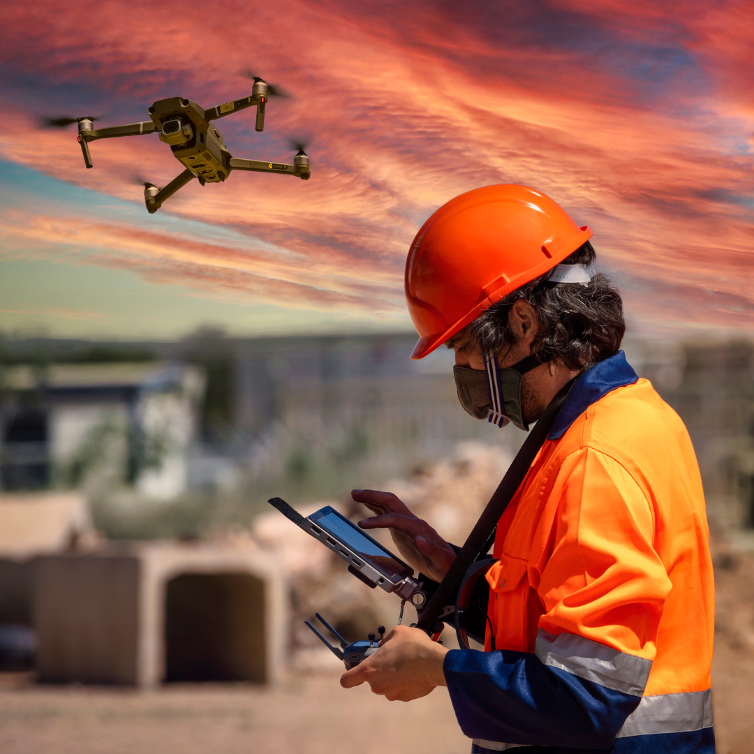
Whether you are needing more effective asset management or regular site fly overs to highlight operational progress and oportunities, our skilled and certified team are here to assist with best in class service.
Servicing projects across South East Queensland
We understand the importance of infrastructure integrity no matter the asset type, which is why our visual and thermal mapping drone services provide the accuracy needed for practical assessments. Operating across the Gold Coast and South East Queensland, our real-time aerial data helps engineers, councils, contractors, and project managers measure dimensions, track progress, and calculate cut-and-fill requirements in bridges, communication towers, and other large-scale infrastructure.
Comprehensive Asset Monitoring Solutions
Serving Diverse Environments

Aerial Asset Intelligence
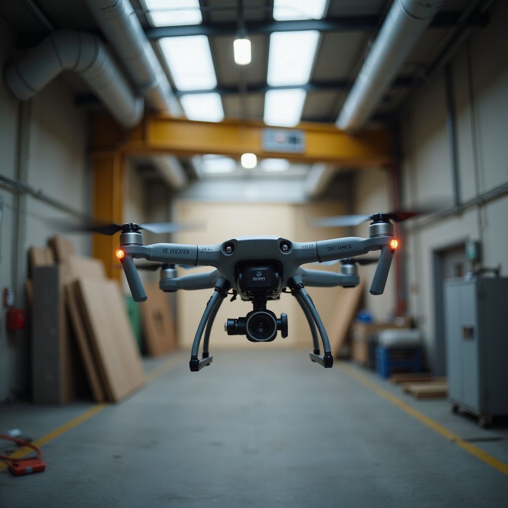
Utilising advanced drone technology, we provide precise aerial monitoring for assets in the sky, ensuring safety and actionable insights.
Ground and Confined Space Solutions

Underwater Asset Monitoring
With our specialist technology, we dive deep to monitor underwater assets, providing detailed insights for effective management.
How it works
How heat mapping offers the following benefits and precision data deliverables
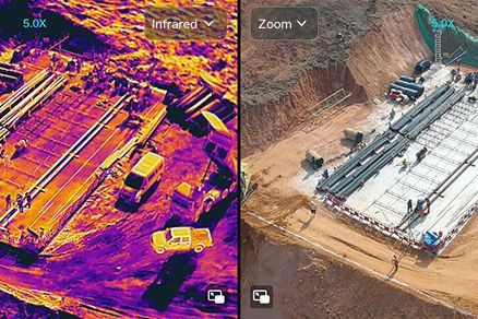
3D modelling and time-lapsing
Generate highly detailed 3D models and time-lapse visuals to monitor site progress, assess structural changes, and enhance project planning.
LiDAR and photogrammetry
Ideal for complex terrains, dense vegetation, and high-detail topography.
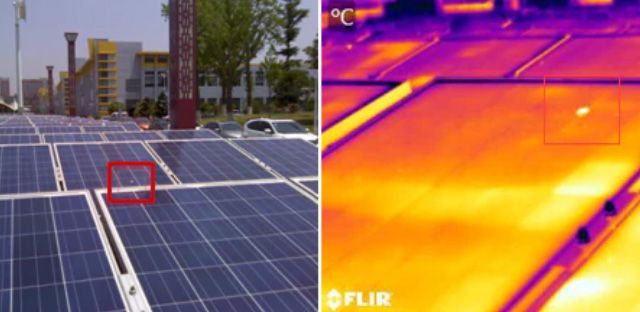
Thermal and multispectral imaging
Analyse soil properties, vegetation health, and other non-visual factors critical to land and site assessments.
Benefits of visual and thermal mapping
- Detects structural weaknesses and heat anomalies early, preventing costly repairs.
- Enhances safety, minimises your carbon footprint and reduces cost by more than 50%.
- Provides precise, real-time data to improve efficiency and decision-making.
- Thermal will detect water leakage in roof spaces and solar panel malfunctions, preventing fires and significant damage costs.
- 3D modelling highlights asset fatigue over time allowing you to make data driven decisions on preventative maintenance which can extend asset lifecycles by over 30%.
Why choose UAS Sentinel for your visual and thermal imaging drone needs
- Industry-leading drone technology:
Our advanced drone fleet is equipped with state-of-the-art thermal sensors, accurately capturing heat signatures to detect structural weaknesses, energy inefficiencies, and potential hazards. - Experienced team delivering actionable insights:
With extensive expertise in aerial asset inspections and thermal imaging, our team translates complex data into clear, actionable insights, providing comprehensive reports tailored to the needs of engineers, councils, and project managers. - Fast, efficient service minimising disruptions to site operations:
Our drone services reduce the need for manual inspections, eliminating downtime and improving site safety. We deliver rapid data collection without interfering with ongoing construction or maintenance, ensuring seamless integration into project workflows.
Decrease your maintenance costs by 50% today
If you’d like to know more about our visual and thermal mapping services and how they could be used to extend the lifecycle of your asset, get in touch with UAS Sentinel by filling out our online enquiry form.
Book your asset inspection
Fill out the form below and a member of our team will be in touch with you soon.